GIS: for designing the city of the future
Designing smarter, sustainable and livable cities for future generations

GIS has become one of the most useful tools for designing the city of the future, which requires the management of large amounts of data from the context. It is now a well-established practice to rely on the use of software to hold together and manage as much spatial data as possible, in order to make urban planning decisions and arrive at projects ready for approval.
The systems that have been working alongside planners for years now are BIM (Building Information Modelling) and GIS (Geographic Information System). Because of their ability to handle large amounts of data and information, they enable site and project models to be generated. This not only increases the degree of reliability of the designs themselves, but also limits errors in the construction phase.
What are GIS?
Geographical information systems (GIS) are software that can analyze, visualize and manage large amounts of data from the land, thus geolocalizing it. In city planning, these software thus make it possible to visualize information from, for example, a building plot. They also make it possible to facilitate the work of the urban planner called upon to intervene at the urban scale by often facilitating those interventions that require predictive capabilities.
GIS has become a tool for sifting, manipulating and interpreting data in a way that was previously unthinkable. Thus enabling intelligent decision making and better management of city resources.

Data useful to the designer include, for example: terrain model, infrastructure information, and environmental data (solar irradiance data, pollution data, demographic information, etc.). By coupling the use of GIS with BIM software, a greater understanding of the site and consequently greater control of the project can be achieved.
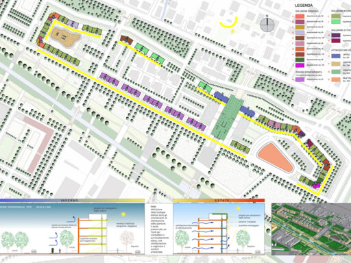
With GIS, one is then able to work on contextualized models by making thematic maps that facilitate environmental and land-use planning.
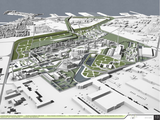
Such models coupled with the use of BIM allow for context-consistent designs and an understanding of the relative potential impacts of the future project on the local area.
Spatial data that can be entered into GIS software are all those data that can be represented and have geographic coordinates. The datasets (lists of data) available and usable in planning practice are almost endless. Among the most useful are OpenData, freely accessible spatial data that are provided by various organizations, agencies and institutions to facilitate access to information. It is also possible to create one’s own datasets through data collection processes (qualitative and quantitative) that analyze phenomena specific to places and of direct interest to the planner.
Why is GIS the premier tool for urban planning?
- It allows for data simplification: visualization of spatially distributed data is much more understandable. Also by overlaying visualizations from various data, it helps the planner make decisions (e.g., for improving the public transportation system).
- Facilitates spatial analysis: it enables the study of the relationship between geographical features. To identify areas of hydrogeological risk, for example, or assess the impact of urban development projects.
- Allows visualization of various scenarios: through simulations. To assess the impacts that various phenomena (such as population growth) may affect cities and territories.
- Involves citizens within decision-making processes: facilitates the inclusion of citizens in urban planning processes through the creation of interactive maps. Tools that can collect data from the very inhabitants and communities to create projects that meet their needs and create projects that can improve public space.
More and more organizations are realizing the importance of a GIS expert within their organizations. These include, by way of example only:
- urban planning agencies
- the environmental agencies
- the departments of transportation
- public health organizations
- real estate companies
- agricultural organizations
- educational and research institutions.
GIS will be increasingly used in city planning partly because the sources from which data come are growing. In addition, the precision of the data collected is increasingly accurate. This will pave the way for increasingly livable and resilient urban designs that can respond to the needs of the area and its citizens in a timely manner.
Cover photo: aerial shot of Salesforce Transit Center in San Francisco, USA. Fonte: freepick.com (wirestock)
